Signs Tagged With Big Green Sign
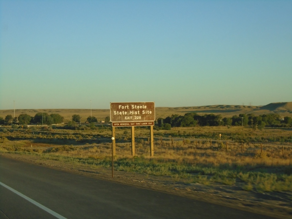
I-80 West - Exit 228
I-80 west approaching Exit 228 - Fort Steele. Use Exit 228 for Fort Steele State Historic Site.
Taken 08-15-2020


 Walcott
Carbon County
Wyoming
United States
Walcott
Carbon County
Wyoming
United States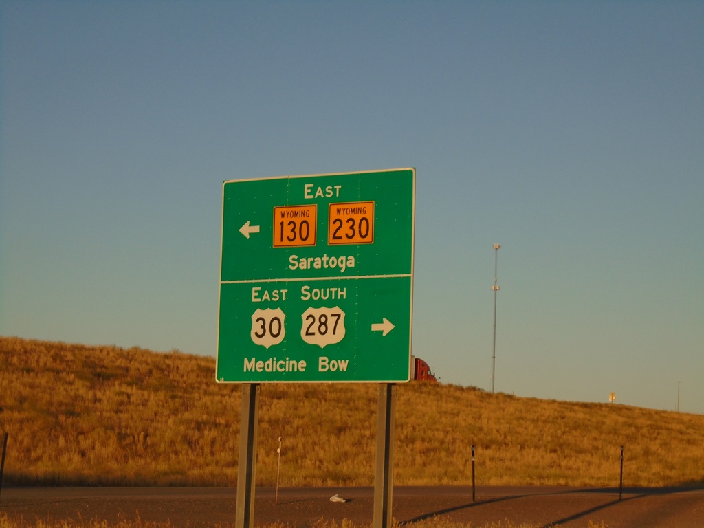
I-80 West Offramp at US-30/US-287/WY-130/WY-230
I-80 West offramp (Exit 235) at US-30/US-287/WY-130/WY-230. Use US-30 East/US-287 South to Medicine Bow. Use WY-130/WY-230 East to Saratoga. US-30 West joins I-80 westbound to Granger; US-287 North joins I-80 westbound to Rawlins.
Taken 08-15-2020

 Walcott
Carbon County
Wyoming
United States
Walcott
Carbon County
Wyoming
United States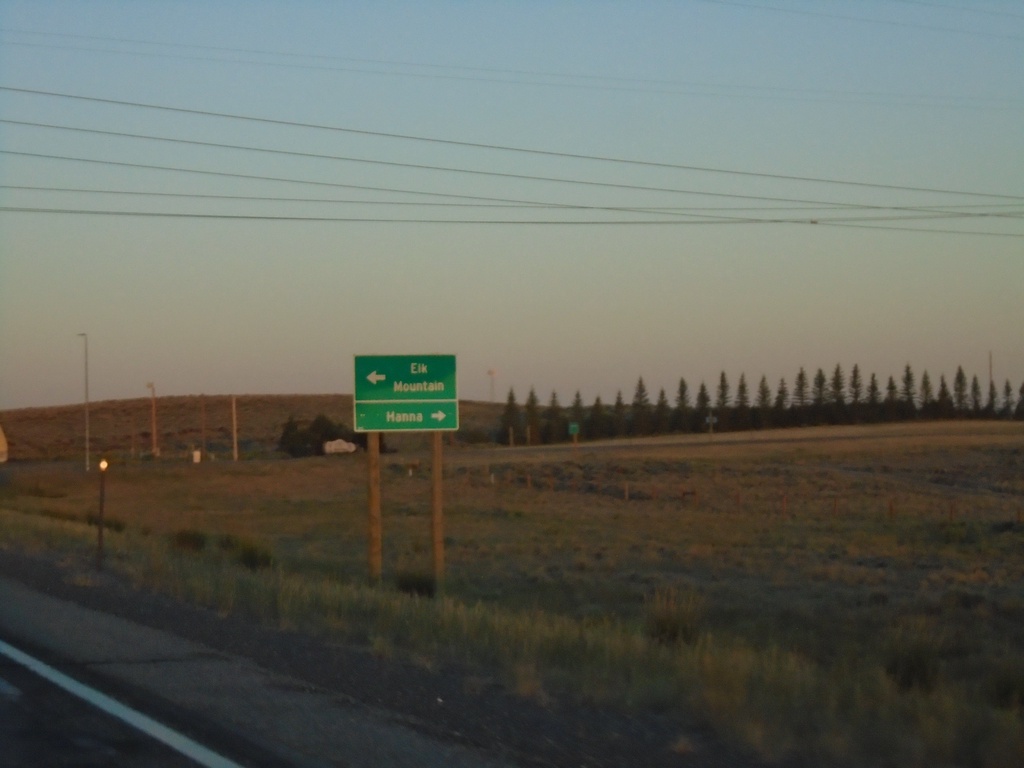
US-30 West/US-287 North At WY-72
US-30 West/US-287 North At WY-72 North to Hanna; south to Elk Mountain.
Taken 08-15-2020
 Hanna
Carbon County
Wyoming
United States
Hanna
Carbon County
Wyoming
United States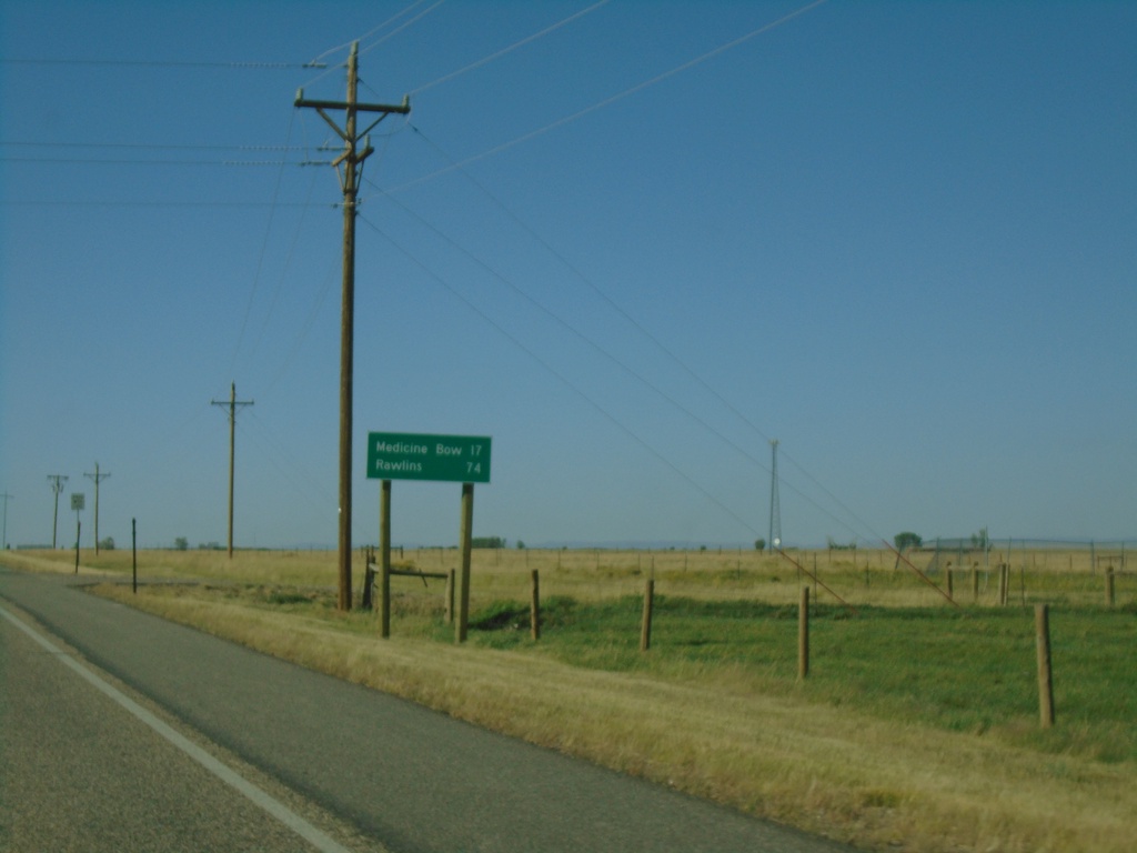
US-30 West/US-287 North - Distance Marker
Distance marker on US-30 West/US-287 North. Distance to Medicine Bow and Rawlins.
Taken 08-14-2020
Rock River
Albany County
Wyoming
United States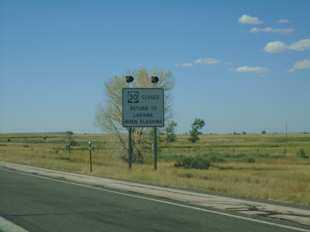
US-30 West/US-287 North - Return To Laramie When Flashing
US-30 West/US-287 North - Road Closed, Return To Laramie When Flashing
Taken 08-14-2020
Bosler
Albany County
Wyoming
United States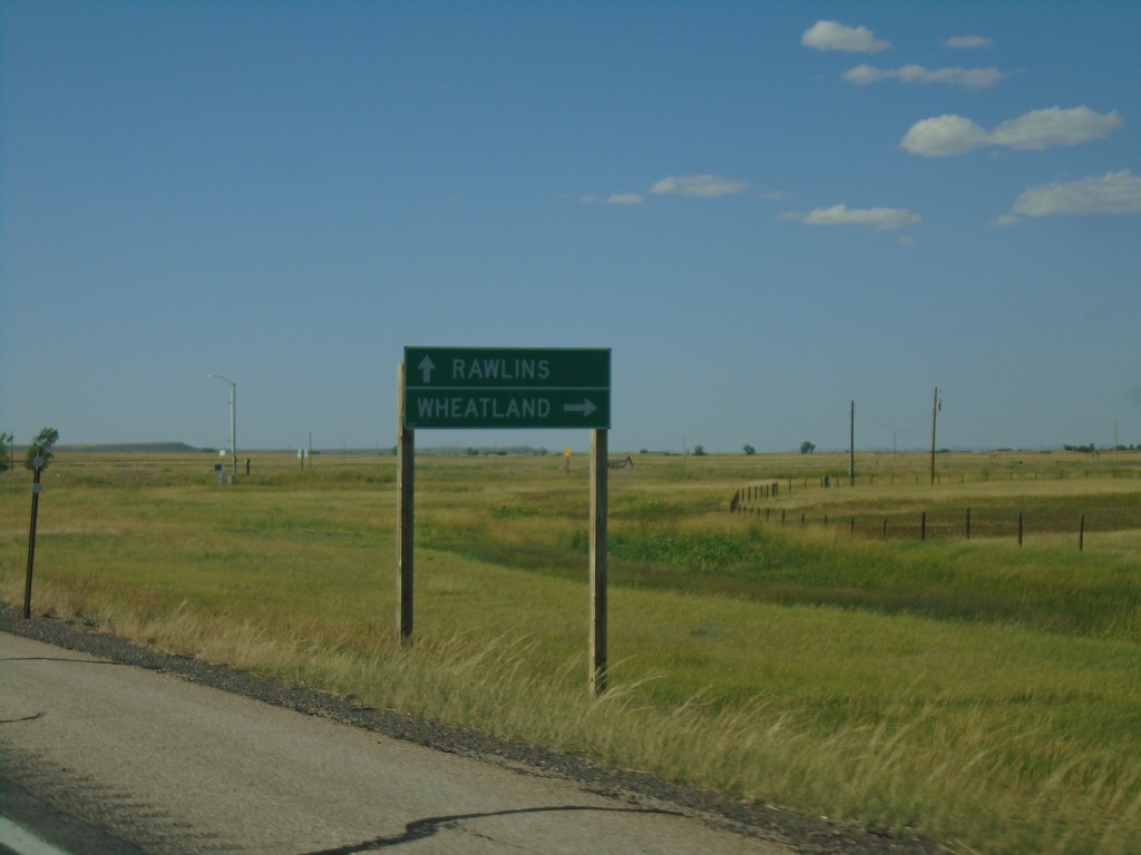
US-30 West/US-287 North At WY-34
US-30 West/US-287 North at WY-34 north to Wheatland. Continue on US-30 West/US-287 North to Rawlins.
Taken 08-14-2020
 Bosler
Albany County
Wyoming
United States
Bosler
Albany County
Wyoming
United States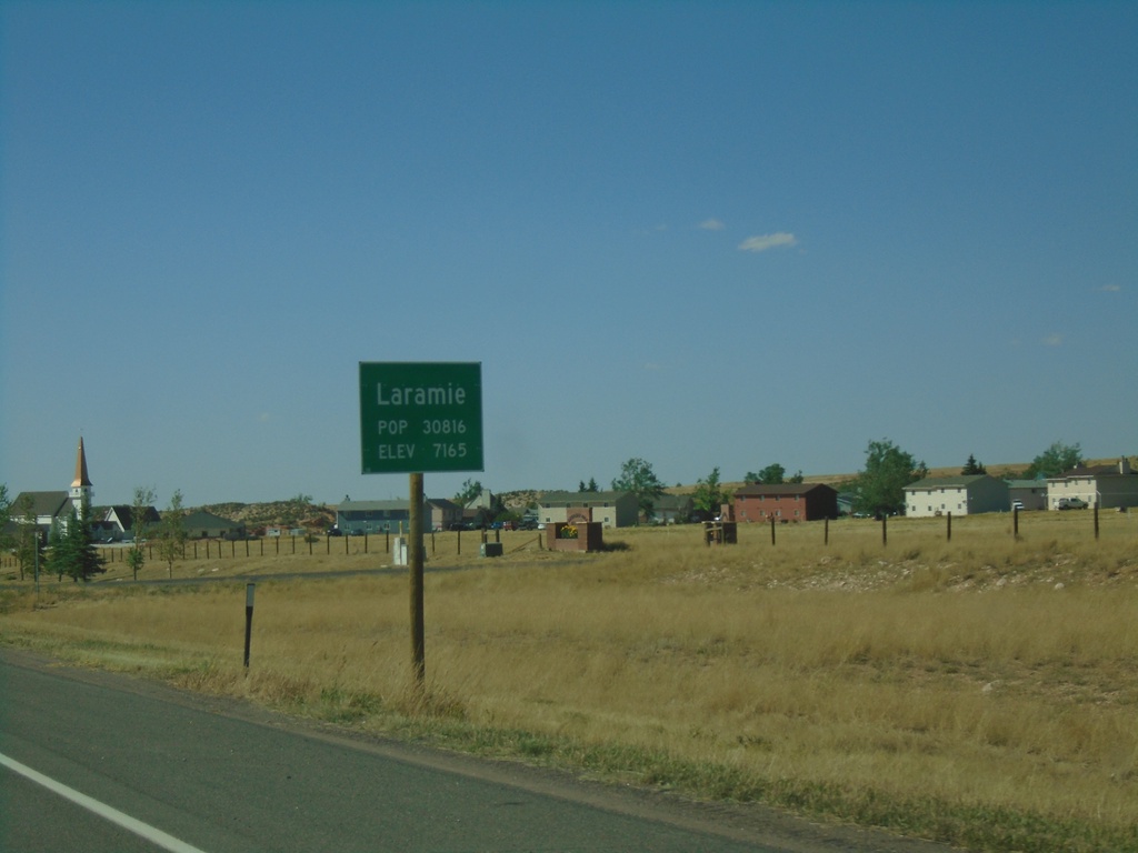
BL-80/US-30 West - Laramie
Entering Laramie on BL-80/US-30 West. Population 30816. Elevation 7165 Feet. Laramie is the third largest city in Wyoming and the home to the University of Wyoming.
Taken 08-14-2020
 Laramie
Albany County
Wyoming
United States
Laramie
Albany County
Wyoming
United States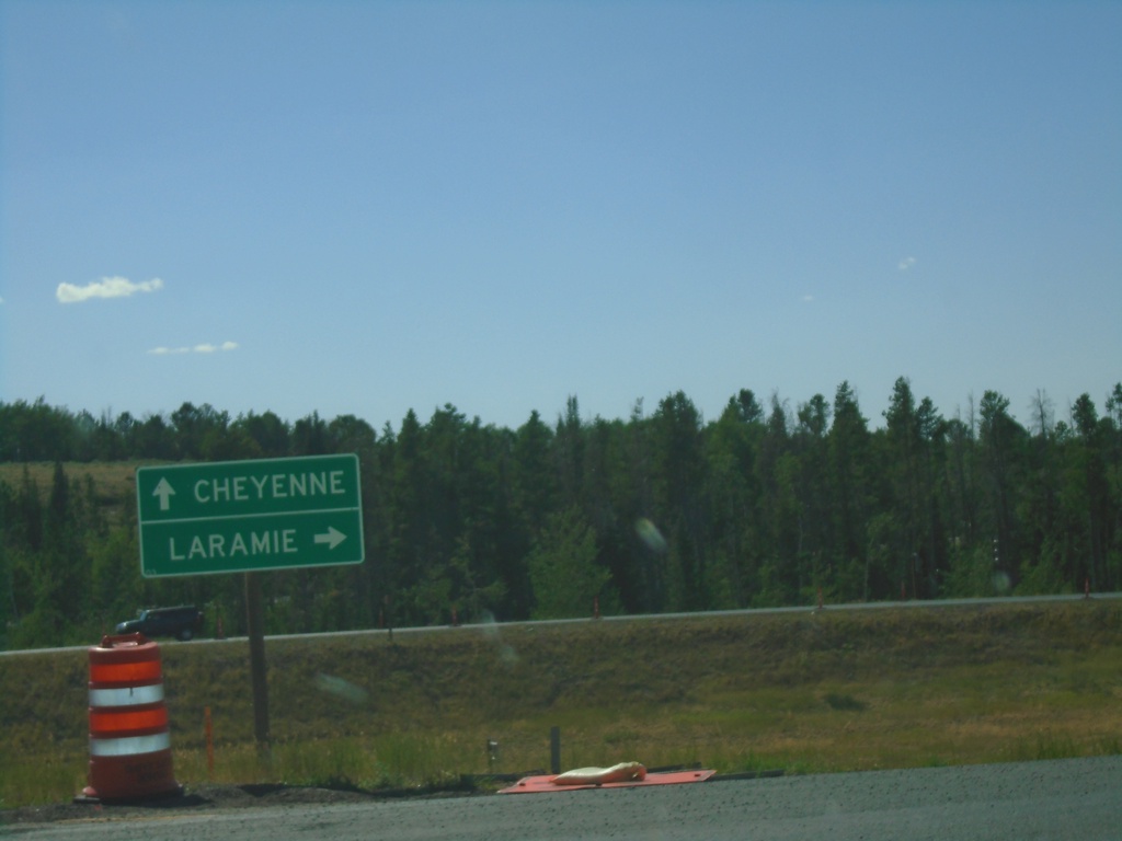
End WY-210 West at I-80/US-30
End WY-210 West (Happy Jack Road) at I-80/US-30. Use I-80/US-30 West for Laramie; I-80/US-30 East for Cheyenne.
Taken 08-14-2020
 Laramie
Albany County
Wyoming
United States
Laramie
Albany County
Wyoming
United States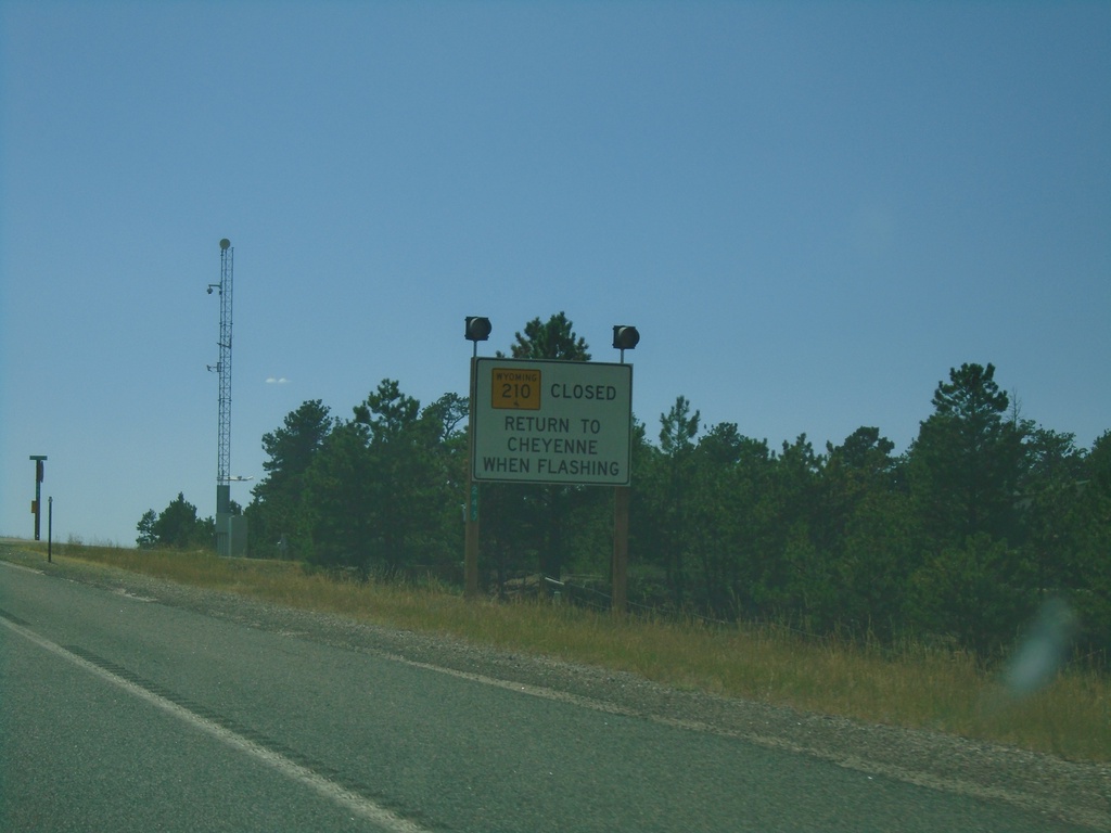
WY-210 West - Return To Cheyenne
WY-210 West - Return to Cheyenne when lights flashing.
Taken 08-14-2020
Cheyenne
Laramie County
Wyoming
United States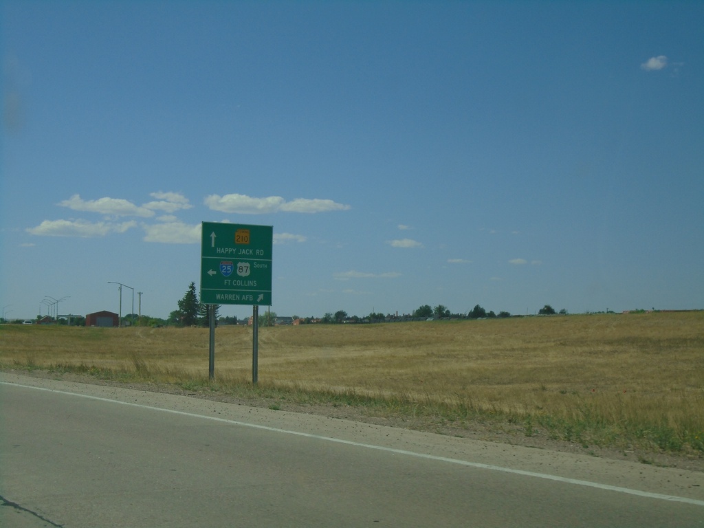
Missile Drive at Warren AFB and I-25 South
Missile Drive at Warren AFB and I-25 South in Cheyenne. Turn right to continue on Missile Drive for Warren AFB; left for I-25/US-87 South/Fort Collins (Colorado); straight for WY-210 West/Happy Jack Road.
Taken 08-14-2020

 Cheyenne
Laramie County
Wyoming
United States
Cheyenne
Laramie County
Wyoming
United States