Signs Tagged With Big Green Sign
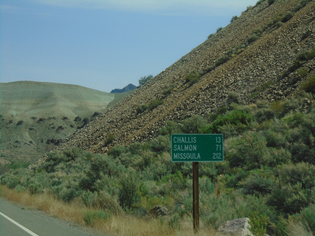
ID-75 North - Distance Marker
Distance marker on ID-75 north. Distance to Challis, Salmon, and Missoula (Montana).
Taken 07-02-2021
 Challis
Custer County
Idaho
United States
Challis
Custer County
Idaho
United States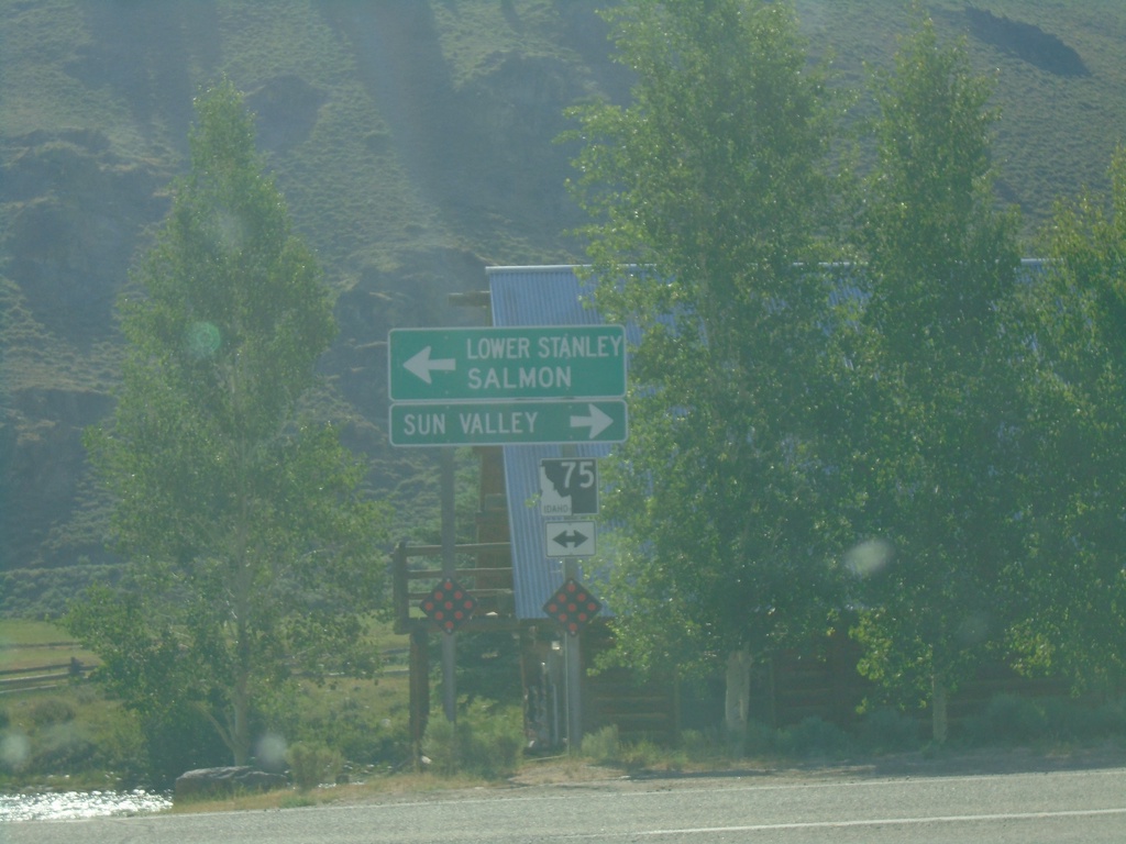
End ID-21 East at ID-75
End ID-21 East at ID-75. Use ID-75 south for Sun Valley. Use ID-75 north for Lower Stanley and Salmon.
Taken 07-02-2021
 Stanley
Custer County
Idaho
United States
Stanley
Custer County
Idaho
United States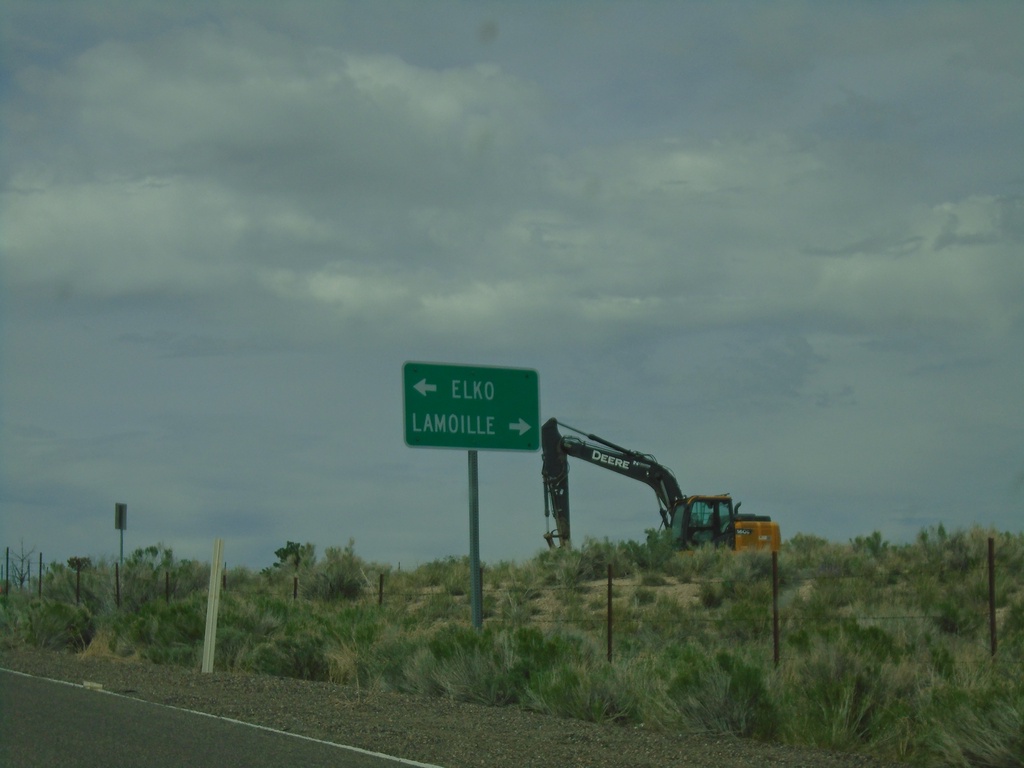
End NV-228 North at NV-227
End NV-228 North at NV-227 in Spring Creek. Use NV-227 West for Elko; NV-227 East for Lamoille.
Taken 05-29-2021

 Spring Creek
Elko County
Nevada
United States
Spring Creek
Elko County
Nevada
United States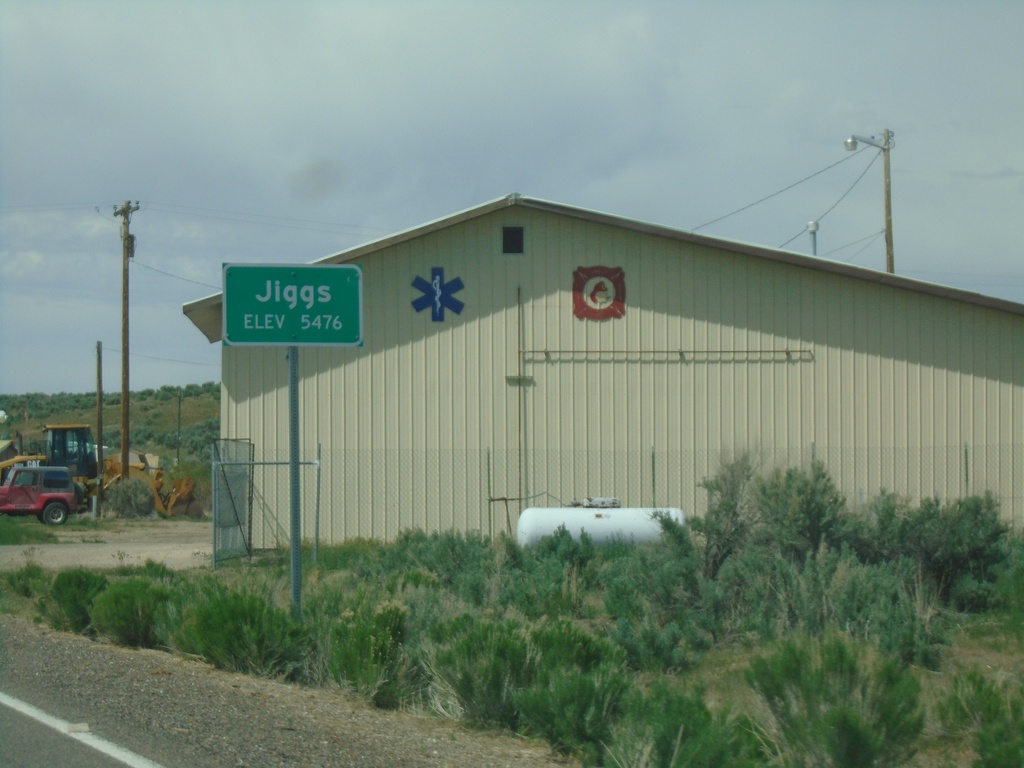
NV-228 North - Jiggs
Entering Jiggs (Elevation 5476 Feet) on NV-228 North
Taken 05-29-2021
Spring Creek
Elko County
Nevada
United States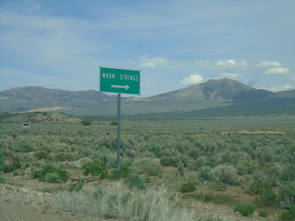
NV-892 North at Warm Springs Jct
NV-892 North at Warm Springs Jct
Taken 05-29-2021
 Eureka
White Pine County
Nevada
United States
Eureka
White Pine County
Nevada
United States
US-50 West - Thirty Mile Jct.
Thirty Mile Jct. on US-50 west in White Pine County.
Taken 05-29-2021
 Ely
White Pine County
Nevada
United States
Ely
White Pine County
Nevada
United States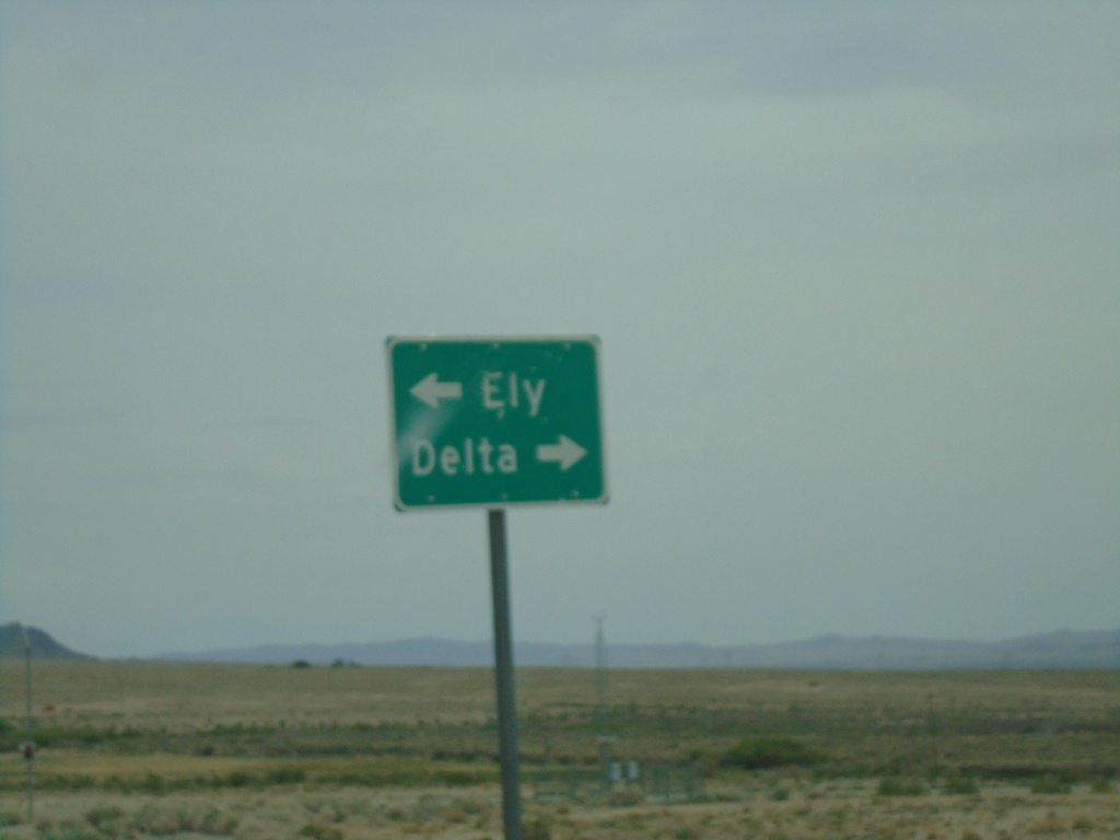
End NV-487 North at US-6/US-50
End NV-487 North at US-6/US-50. Use US-6/US-50 West to Ely; US-6/US-50 East to Delta (Utah).
Taken 05-29-2021

 Baker
White Pine County
Nevada
United States
Baker
White Pine County
Nevada
United States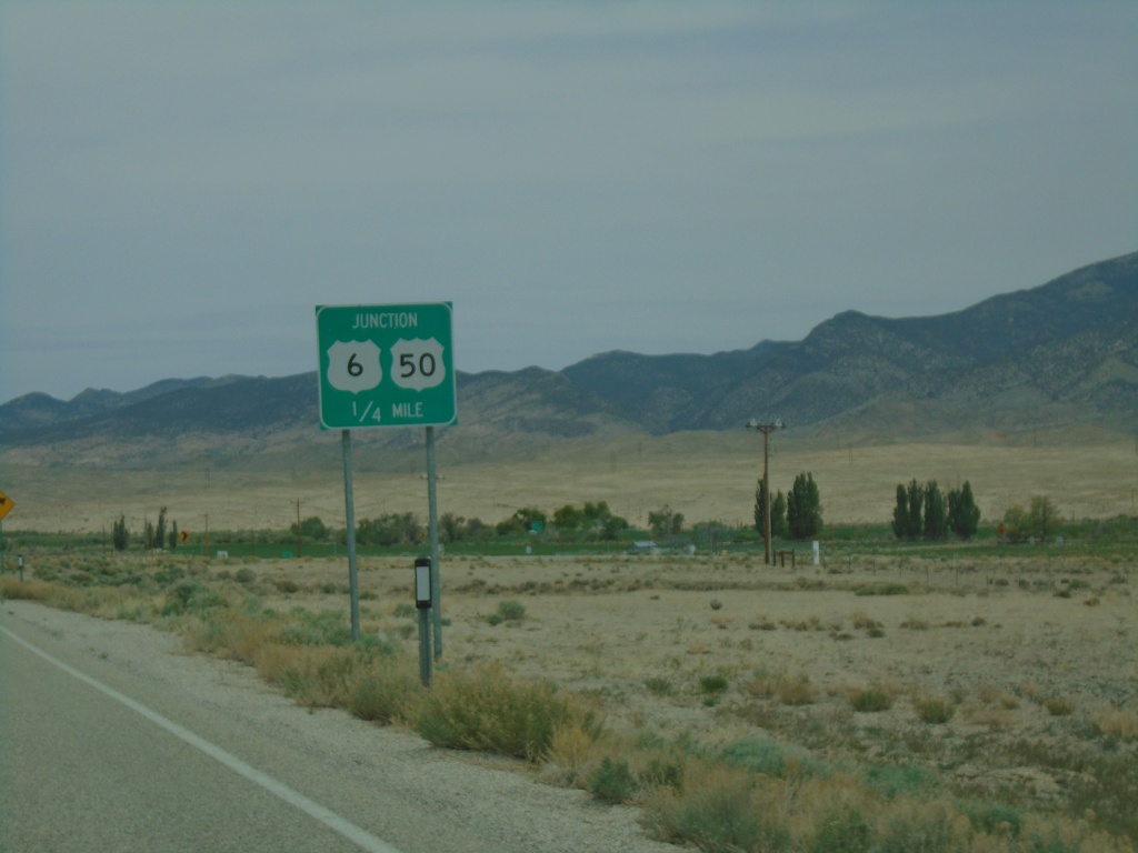
NV-487 North Approaching US-6/US-50
NV-487 North approaching US-6/US-50 in White Pine County.
Taken 05-29-2021
Baker
White Pine County
Nevada
United States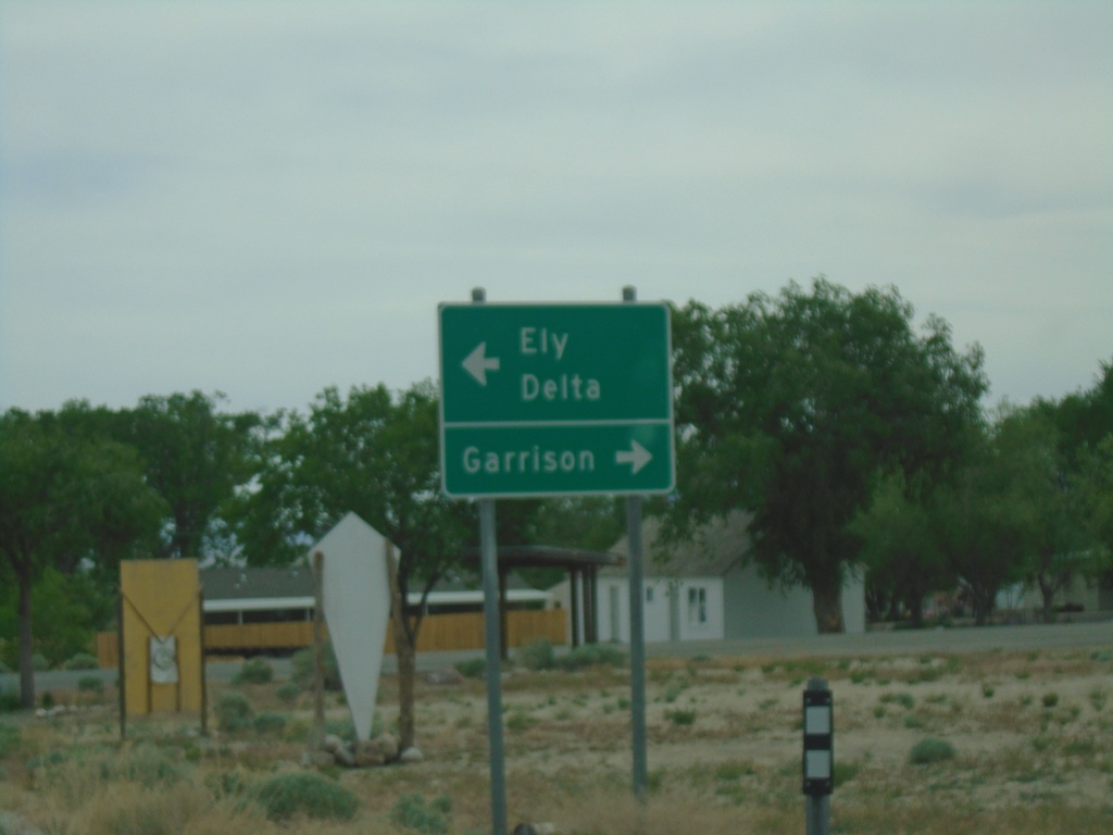
End NV-488 East at NV-487
End NV-488 East at NV-487 in Baker. Use NV-487 south for Garrison (Utah). Use NV-487 north for Delta (Utah) and Ely.
Taken 05-29-2021
 Baker
White Pine County
Nevada
United States
Baker
White Pine County
Nevada
United States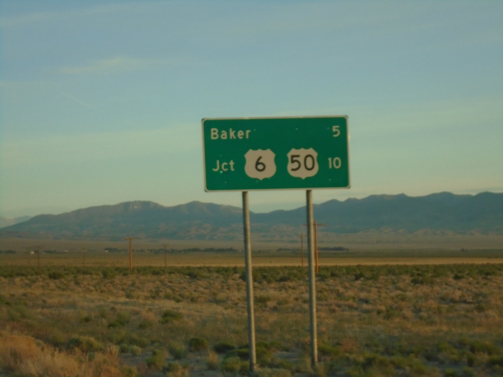
NV-487 North - Distance Marker
Distance marker on NV-487 North. Distance to Baker and US-50/US-6 Junction.
Taken 05-29-2021
Baker
White Pine County
Nevada
United States