Signs Tagged With Big Green Sign
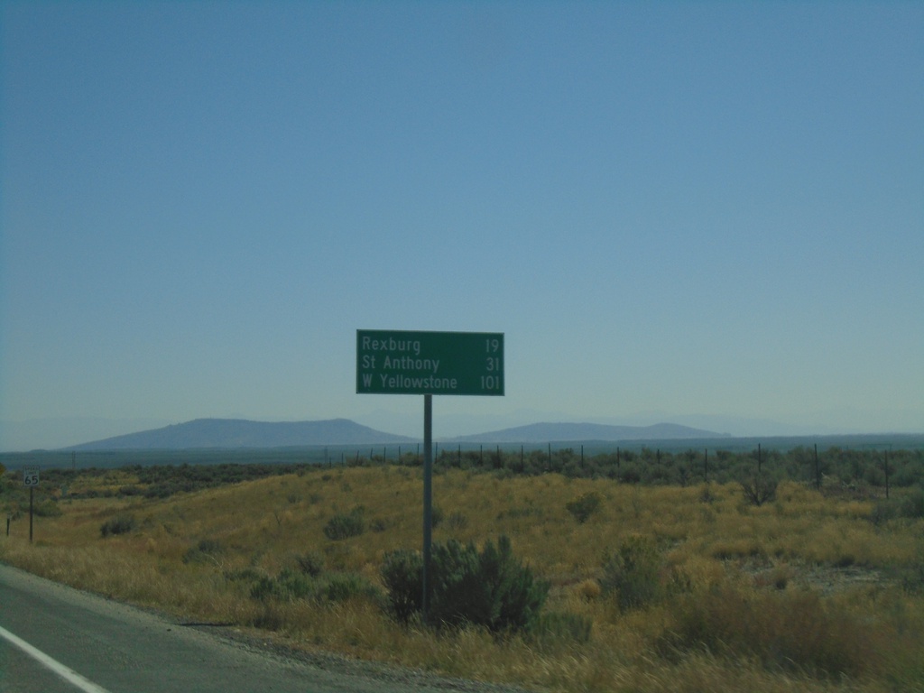
ID-33 East - Distance Marker
Distance marker on ID-33 East. Distance to Rexburg, St. Anthony (via US-20 East), and West Yellowstone (Montana via US-20 East).
Taken 09-24-2021
 Hamer
Jefferson County
Idaho
United States
Hamer
Jefferson County
Idaho
United States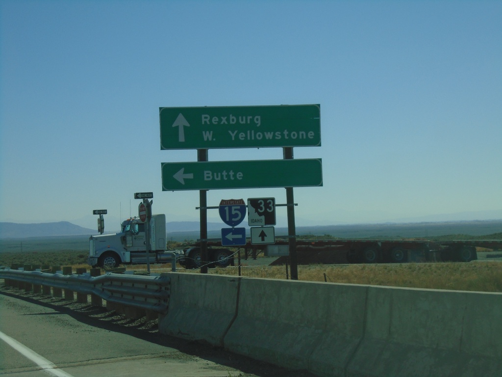
ID-33 East at I-15 North
ID-33 East at I-15 North (Exit 143). Use I-15 North for Butte (Montana). Continue east on ID-33 for Rexburg and West Yellowstone (Montana).
Taken 09-24-2021
 Roberts
Jefferson County
Idaho
United States
Roberts
Jefferson County
Idaho
United States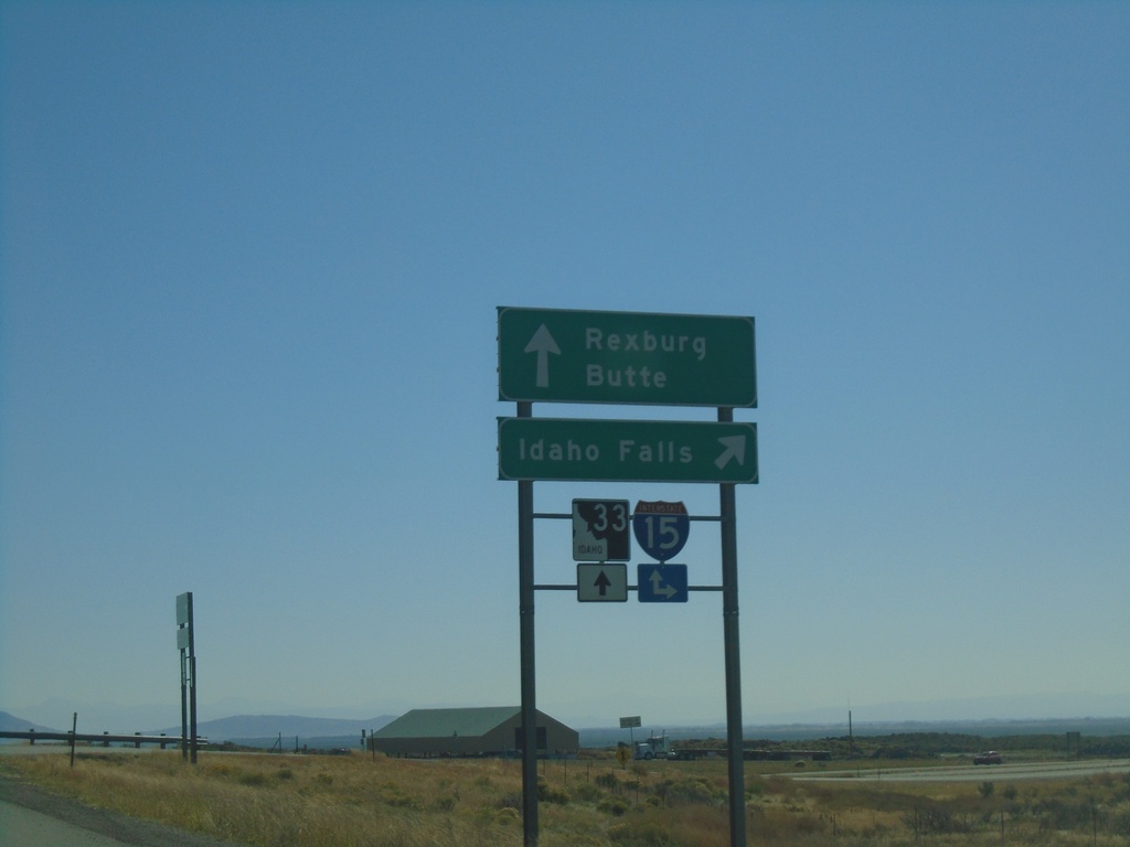
ID-33 East at I-15 South
ID-33 east at I-15 south to Idaho Falls. Continue over overpass for I-15 north onramp to Butte (Montana). Continue east on ID-33 for Rexburg.
Taken 09-24-2021
Sage Junction
Jefferson County
Idaho
United States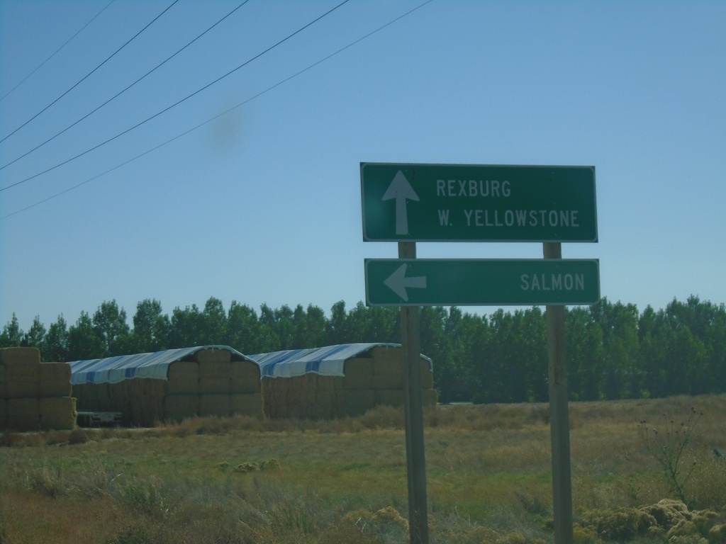
ID-33 East at ID-28
ID-33 east at ID-28 north to Salmon. Continue east on ID-33 for Rexburg and West Yellowstone (Montana). This is the southern end of ID-33. The Sacajawea Historic Byway turns from ID-28 to ID-33 east here.
Taken 09-24-2021
 Mud Lake
Jefferson County
Idaho
United States
Mud Lake
Jefferson County
Idaho
United States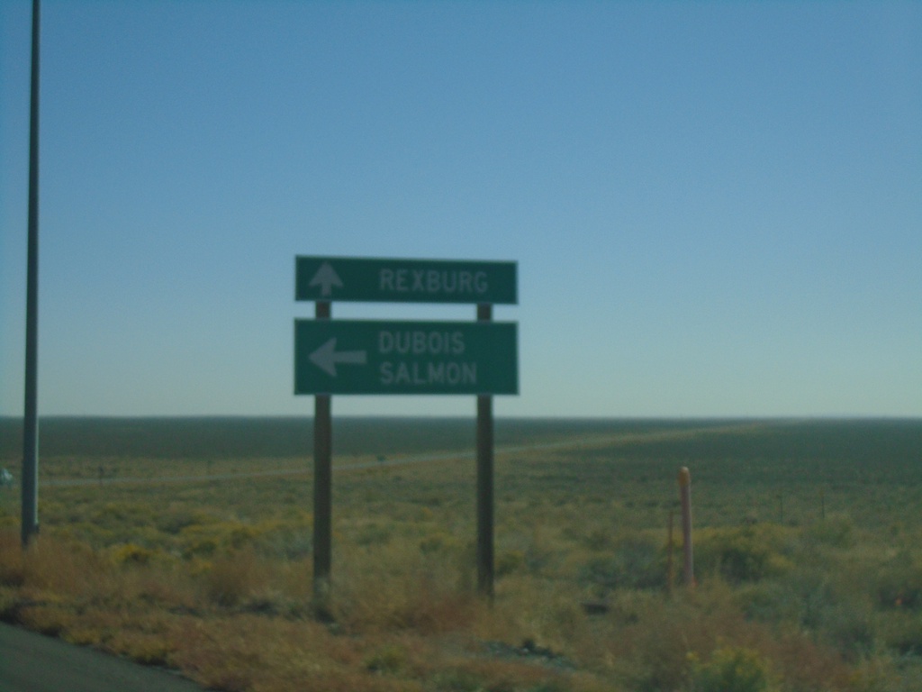
ID-33 East at ID-22 East
ID-33 east at ID-22 east to Dubois and Salmon (via ID-28). Continue east on ID-33 for Rexburg.
Taken 09-24-2021
 Howe
Butte County
Idaho
United States
Howe
Butte County
Idaho
United States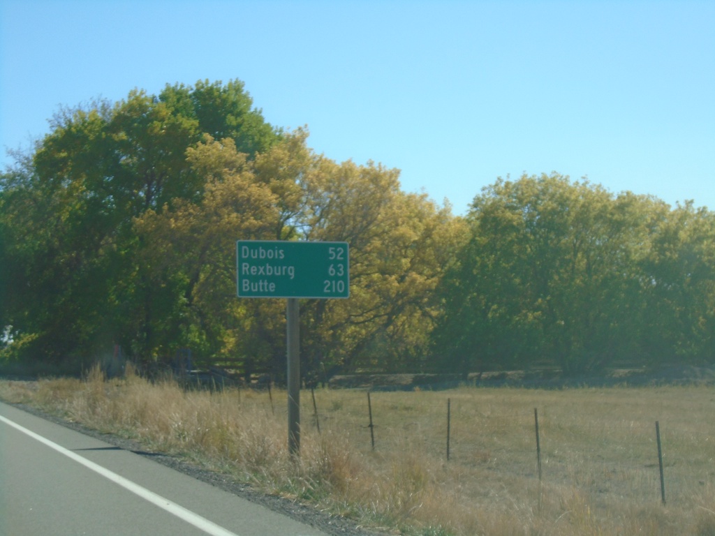
ID-33 East - Distance Marker
Distance marker on ID-33 east. Distance to Dubois (via ID-22), Rexburg, and Butte (Montana - via ID-22 and I-15).
Taken 09-24-2021
Howe
Butte County
Idaho
United States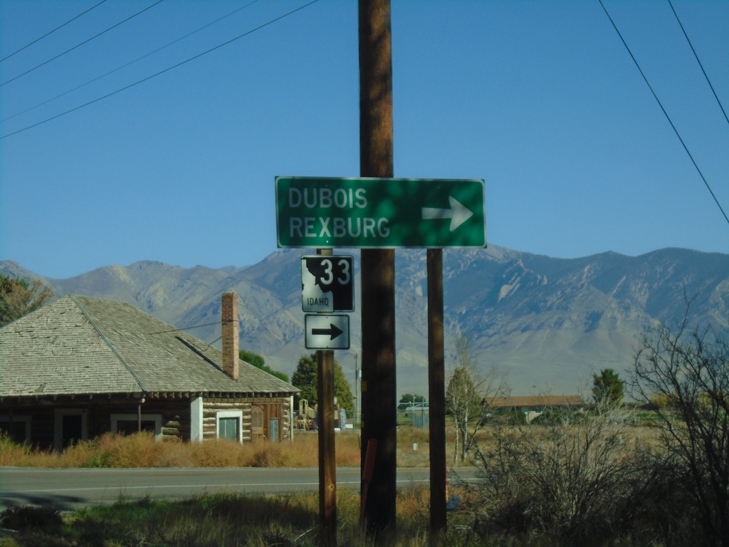
ID-33 East at Little Lost River Highway
ID-33 East at Little Lost River Highway in Howe. Turn right to continue east on ID-33 towards Dubois and Rexburg.
Taken 09-24-2021
Howe
Butte County
Idaho
United States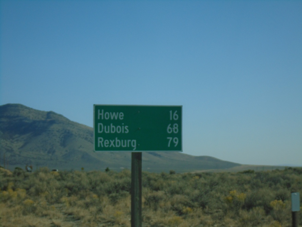
ID-33 East - Distance Marker
Distance marker on ID-33 east. Distance to Howe, Dubois (via ID-22), and Rexburg.
Taken 09-24-2021
Butte City
Butte County
Idaho
United States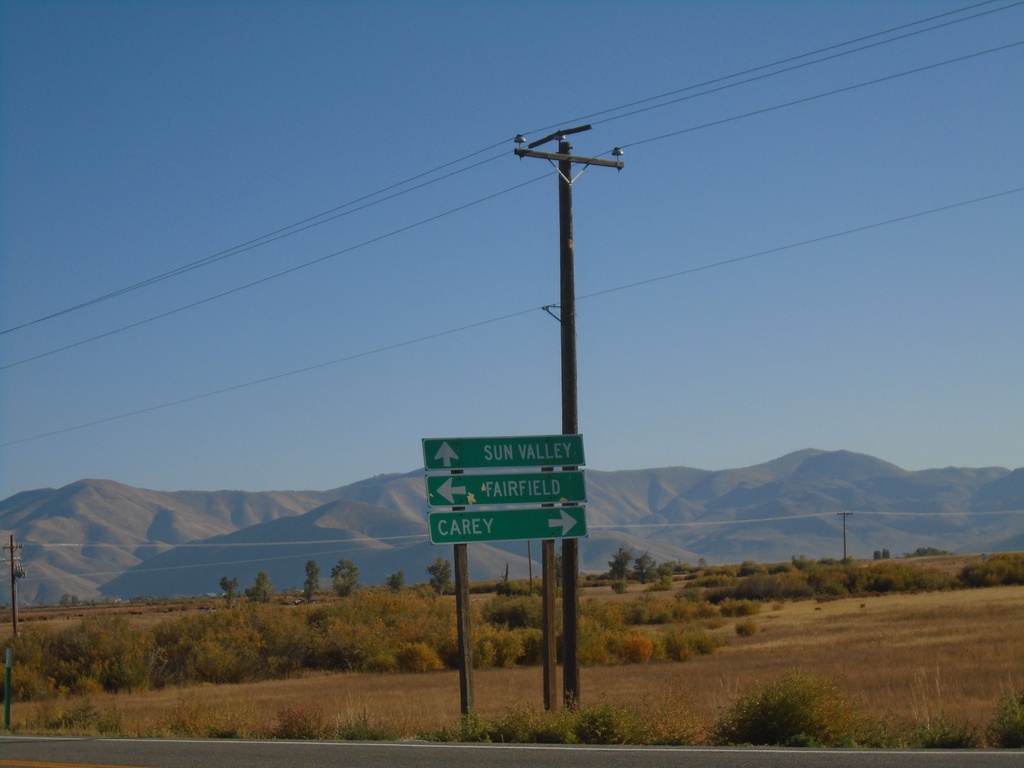
ID-75 North at US-20
ID-75 north at US-20. Use US-20 east for Carey; US-20 west for Fairfield. Continue north to Sun Valley.
Taken 09-24-2021

 Bellevue
Blaine County
Idaho
United States
Bellevue
Blaine County
Idaho
United States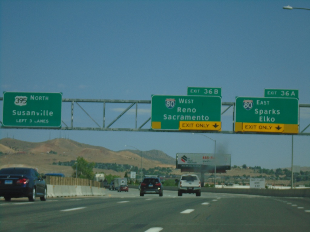
I-580/US-395 North - Exits 36A and 36B
I-580/US-395 north approaching Exits 36A and 36B. Exit 36A - I-80 East/Sparks/Elko. Exit 36B - I-80 West/Reno/Sacramento (California). US-395 continues north towards Susanville (California). I-580 ends at I-80. The freeway continues as US-395.
Taken 07-12-2021


 Reno
Washoe County
Nevada
United States
Reno
Washoe County
Nevada
United States