Signs Tagged With Arizona Highway
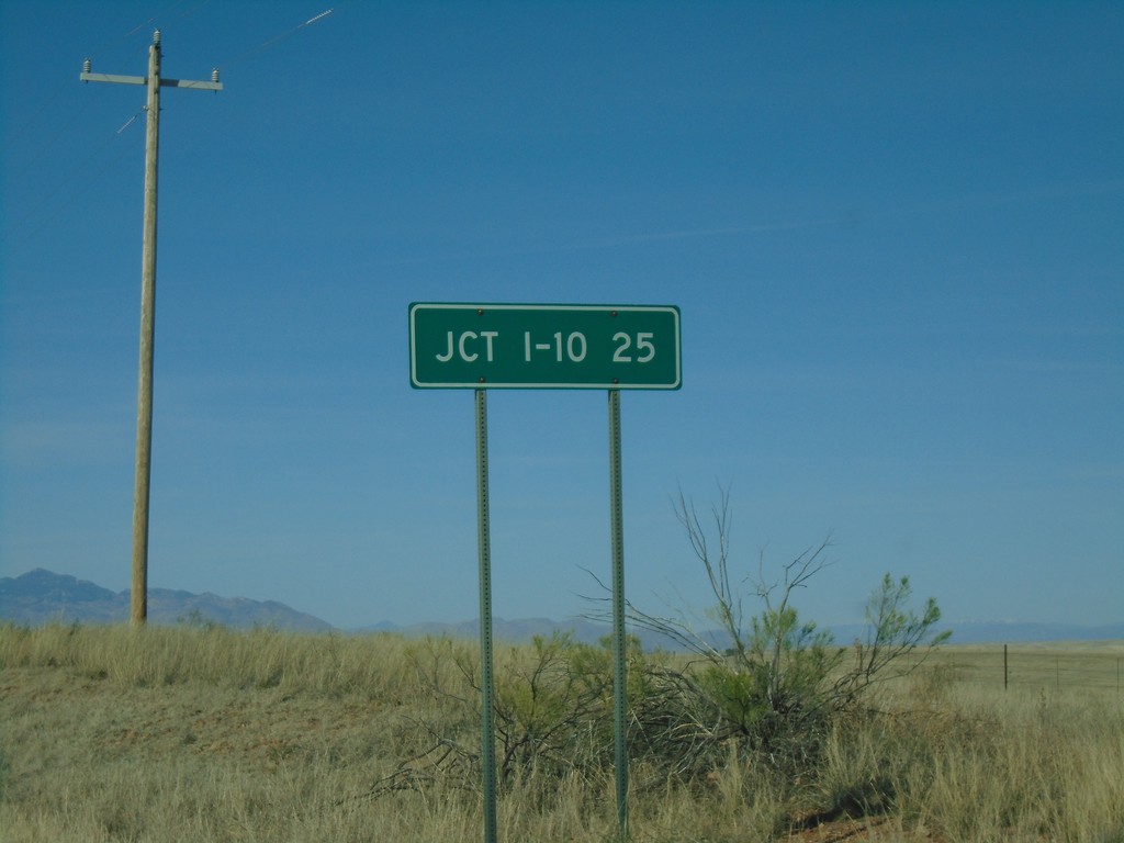
AZ-83 North - Distance Marker
Distance marker on AZ-83 north. Distance to I-10.
Taken 03-23-2019

 Sonoita
Santa Cruz County
Arizona
United States
Sonoita
Santa Cruz County
Arizona
United States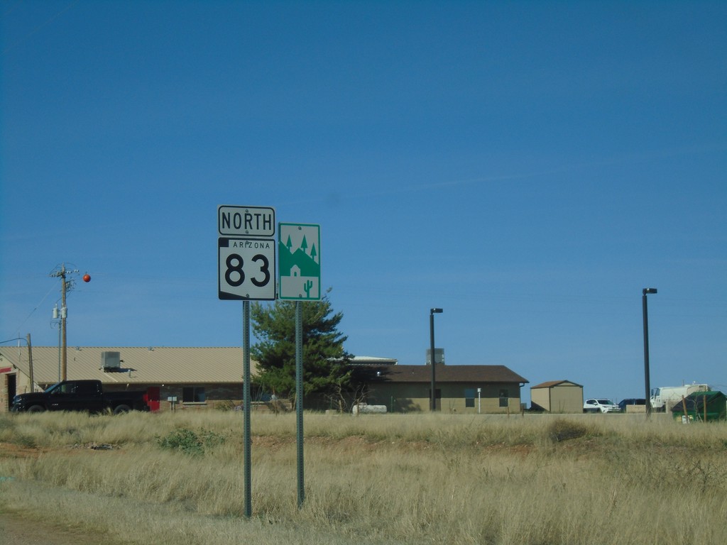
AZ-83 North - Scenic Byway
AZ-83 North and Scenic Byway sign in Sonoita. AZ-83 is part of the Patagonia-Sonoita Scenic Road.
Taken 03-23-2019
Sonoita
Santa Cruz County
Arizona
United States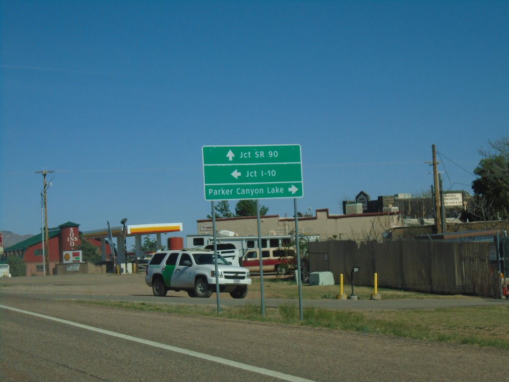
AZ-82 East Approaching AZ-83
AZ-82 east approaching AZ-83. Use AZ-83 north for I-10. Continue east on AZ-82 for SR-90. Turn right on county road for Parker Canyon Lake.
Taken 03-23-2019
 Sonoita
Santa Cruz County
Arizona
United States
Sonoita
Santa Cruz County
Arizona
United States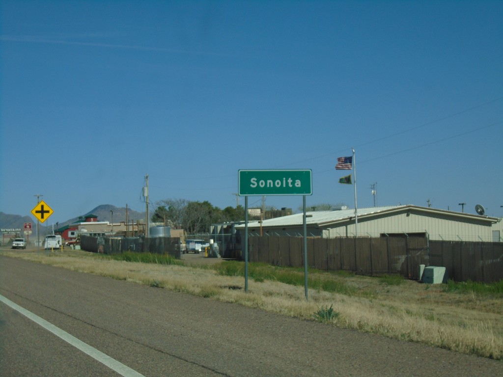
AZ-82 East - Sonoita
Entering Sonoita on AZ-82 East.
Taken 03-23-2019
Sonoita
Santa Cruz County
Arizona
United States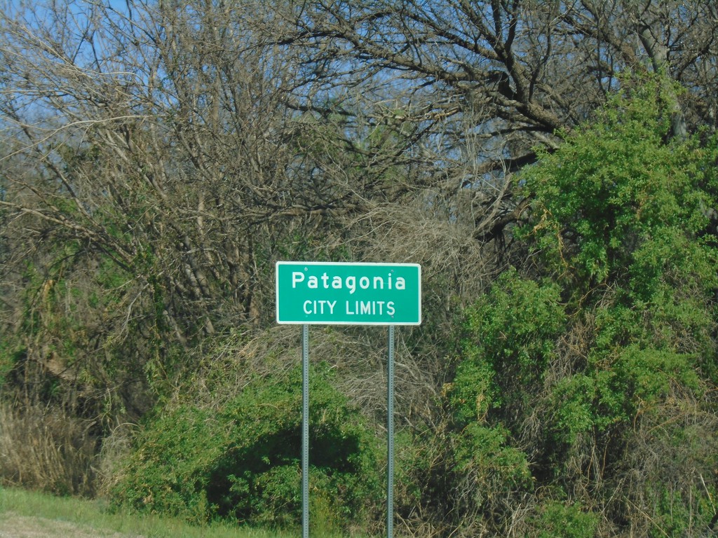
AZ-82 East - Patagonia City Limits
Patagonia City Limits on AZ-82 East.
Taken 03-23-2019
Patagonia
Santa Cruz County
Arizona
United States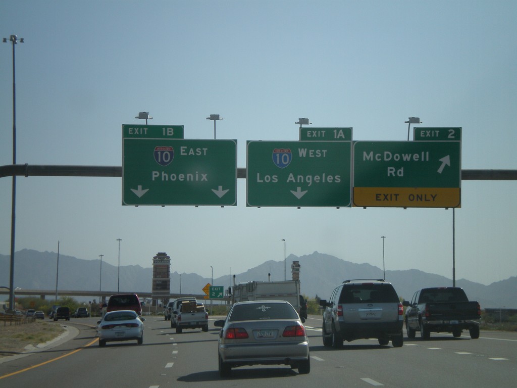
AZ-101 South - Exit 2 and Exit 1AB
AZ-101 Loop South at Exit 2 - McDowell Road. Approaching Exit 1B - I-10 East/Phoenix.
Taken 03-23-2009
 Phoenix
Maricopa County
Arizona
United States
Phoenix
Maricopa County
Arizona
United States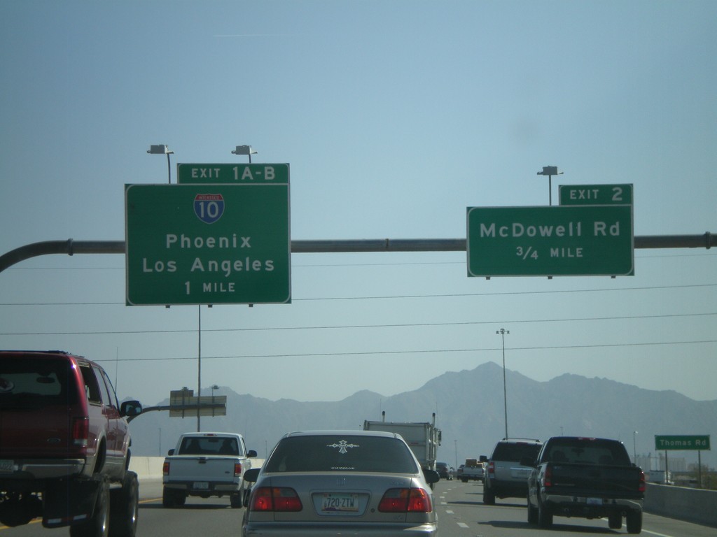
AZ-101 Loop South - Exit 2 and Exit 1AB
AZ-101 Loop South approaching Exit 2 - McDowell Road and Exit 1AB-I-10/Phoenix/Los Angeles.
Taken 03-23-2009
Phoenix
Maricopa County
Arizona
United States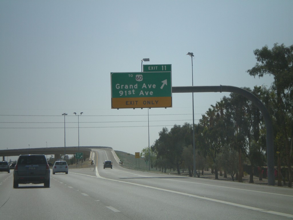
AZ-101 Loop South - Exit 11
AZ-101 Loop South at Exit 11 - To US-60/Grand Ave./91st Ave.
Taken 03-23-2009
 Peoria
Maricopa County
Arizona
United States
Peoria
Maricopa County
Arizona
United States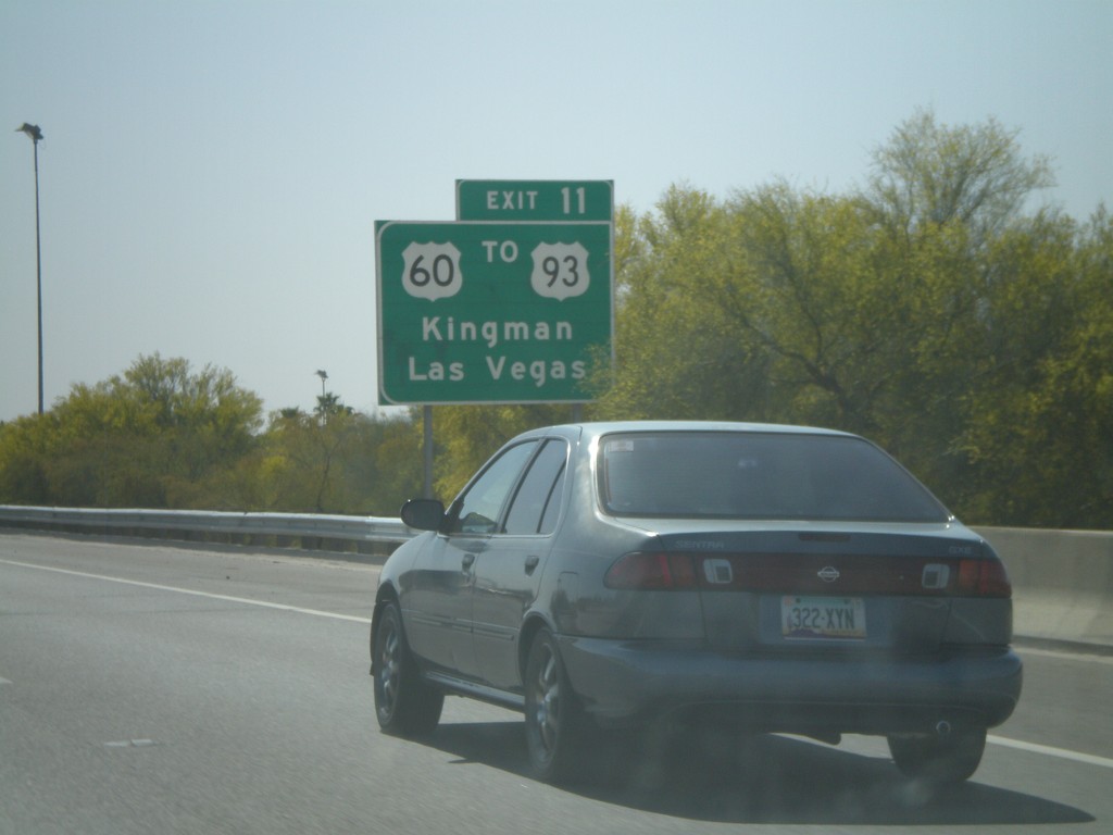
AZ-101 Loop South Approaching Exit 11
AZ-101 Loop South approaching Exit 11. Use Exit 11 for US-60/To US-93/Kingman/Las Vegas.
Taken 03-23-2009
 Peoria
Maricopa County
Arizona
United States
Peoria
Maricopa County
Arizona
United States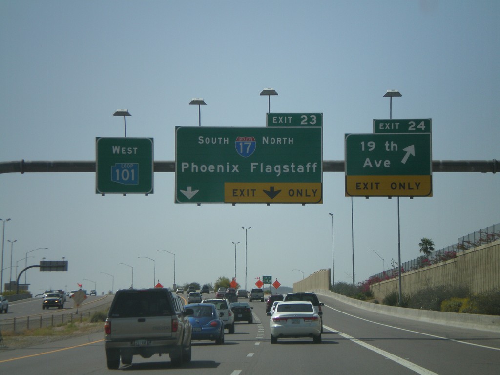
AZ-101 West - Exit 23 and Exit 24
AZ-101 Loop West at Exit 24 - 19th Ave. Approaching Exit 23 - I-17/Phoenix/Flagstaff. All of the loop highways around Phoenix have different color shields on the older signs. AZ-101 Loop has a blue shield.
Taken 03-23-2009
 Phoenix
Maricopa County
Arizona
United States
Phoenix
Maricopa County
Arizona
United States